A New Neighbourhood Walk, Planned Around Its Connections
Plan a new neighbourhood walk by linking a main street, transit stop and shared public place, so you can understand how everyday routes fit together.
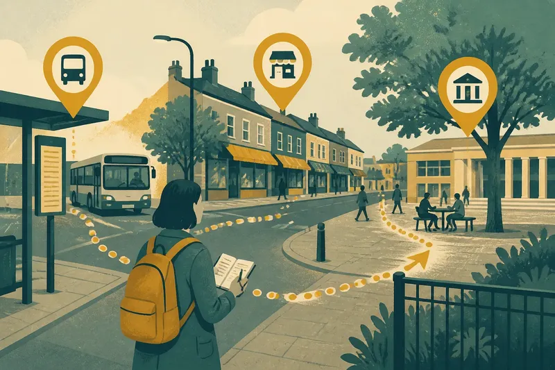
You step off a bus on an unfamiliar street, hear a delivery van reverse and spot a row of shops beyond the next junction. A new neighbourhood walk can begin with those ordinary clues: follow a main street, connect it to a transit stop and finish at a shared public place. The aim is not to cover ground quickly. It is to notice how the pieces link up, and what those links make possible.
What is a connection-led walk?
A connection-led walk follows a simple chain between three kinds of place: a main street, a transit stop and a shared public place such as a library forecourt, market square or riverside promenade. Each point helps you read the others. The street shows where daily activity gathers; the stop reveals how people arrive and leave; the public place offers a pause from movement.
This is a way to explore, not a route-planning exercise with a perfect answer. You might begin at the transit stop and walk towards the main street, or start at a busy stretch of shops and trace the nearest route to a place where people can sit. The sequence matters less than the links you can observe between the three.
Keep the walk modest. Choose destinations that are easy to identify on a map, then leave room for a detour or a change of mind. A pavement that narrows, a sign pointing towards a station or a glimpse of a public square can all alter your route. Those small decisions are part of the subject: they show how a neighbourhood invites, directs or slows movement.
How do you choose a starting point?
Start somewhere you can identify without needing local knowledge. A bus stop, tram platform, railway entrance or clearly named main street makes a useful anchor. If you are arriving by public transport, the stop is a natural first point. If you are already nearby, use a recognisable shop-lined street and find the closest transit connection on a map.
Look for a public place that appears connected to both. It might sit beside the high street, occupy a gap between blocks or lie along a route from the station. A place marked as a square on a map may turn out to be a paved forecourt; a green patch may have no obvious entrance from the street. Treat the map as a prompt, then check what the route is like on foot.
For a first visit, avoid making the walk depend on a hidden shortcut or an entrance whose opening arrangements are unclear. Choose a route that can be followed along public streets and obvious paths. If a gate is closed or a way through feels uncertain, turn back and use the nearest clear street connection instead.
How should you connect the three places?
Use the route between destinations to ask what connects them in practice. A direct line on a map may cross a busy road, pass beneath a railway or follow a path that is hard to find from the pavement. A slightly longer street route can be easier to understand and more comfortable to walk. The useful question is not simply “How far apart are these places?” but “Can I see how one leads to the next?”
Check whether signs point towards the stop, whether a crossing continues the route, and whether the public place has an entrance facing the street you are using. Notice changes in pavement width, lighting, shade and activity without assuming that one feature tells the whole story. A route can be busy yet confusing, or quiet yet easy to follow.
Say you arrive at a neighbourhood library by bus and want to reach its main street and a nearby paved gathering place. You might walk from the stop along the signed street, note where the shopfronts become more continuous, then follow the public path that leads towards the library forecourt. If a fence blocks that path, the observable result is a broken link; you can take the surrounding street and see whether another entrance makes the forecourt feel connected after all.
What should you notice on the route?
Watch for the details that help a person make the next move. These are more useful than trying to judge a whole neighbourhood from one glance:
- Direction: Can you see the next destination, or does a sign make its location clear?
- Continuity: Does the walking route carry on naturally across junctions, or does it seem to stop?
- Crossings: Are there clear places to cross between the stop, street and public place?
- Entrances: Can you tell where the public place begins and how to enter it from the route?
- Activity: Where do people pause, queue, meet or continue without stopping?
- Edges: Do shopfronts, walls, railings or planted borders make the route feel open, enclosed or difficult to read?
Keep observations separate from conclusions. “There is no sign at this corner” is something you can check. “Visitors are unwelcome here” is a broader interpretation that needs more than a single moment. You can note both your immediate impression and what caused it: a blank wall, a locked gate, a busy driveway or simply not knowing where to look.
Listen as well as look. A stop announces itself through arrivals, doors and voices; a main street may have a steady rhythm of shopping and deliveries; a shared place can be quiet, crowded or used as a shortcut. These sounds help explain whether the places operate as one connected area or as separate islands.
What if a route feels unclear?
If the route becomes hard to read, pause at a safe, public place and check a map. Compare the map with what is actually visible: a street name, a station entrance, a path sign or a public-place boundary. Do not assume that a mapped line is an open pedestrian route. If there is no clear way through, return to the last point you recognised and choose a visible public street.
A detour can tell you something useful. It may reveal that a railway, large block or busy road divides two places that look close together on a map. It can also show that the main entrance sits on a different side from the one you expected. The point is not to prove that the neighbourhood is well or poorly connected, but to notice where the route becomes legible and where it asks for extra effort.
If you are exploring with another person, agree on a simple check-in point, such as the transit stop or a named public building, before splitting up. Keep to public routes and choose a different outing if conditions, access needs or local restrictions make the planned walk unsuitable. A route should be adaptable, not a test of endurance.
Can you make the walk your own?
Yes. Choose the kind of connection you want to understand. A visitor might trace the clearest route from a station to a market square. Someone considering a new local library might look at how its entrance connects to bus stops and nearby shops. A resident could follow the way from a familiar main street to a public place they have never used.
Change one feature at a time. You could begin at the public place instead of the stop, or follow a quieter parallel street back towards the main road. This makes comparison easier: you can see whether the alternative route is easier to follow, offers a different view of local activity or meets the same destinations less directly. Avoid turning the walk into a scorecard; the goal is to understand the choices the street network presents.
A phone map can help with orientation, but you do not need to stare at it throughout. Check the next junction, put it away while walking, and look up for signs and entrances. If the map uses a label you cannot match to the street, rely on visible public routes rather than guessing at a shortcut.
What questions help you read the connections?
How can I tell if the main street connects to the stop?
Follow the route in both directions and look for signs, visible entrances and crossings that make the link clear. Note where the path changes or becomes difficult to follow, rather than judging only by how close the places appear on a map.
What counts as a shared public place?
Look for a place that people can enter or use as part of ordinary public life, such as a square, library forecourt or public riverside path. A space may look open but have restricted access, so check the signs and boundaries you encounter.
Should I follow the shortest route?
Not necessarily. A direct route may be hard to cross or may pass an entrance that is difficult to find, while a slightly longer street can make the connection clearer. Choose based on the route you can actually see and follow.
What should I do if the public place is closed?
Do not enter through a barrier or assume a closed space is accessible from another side. Observe its edges from the public street, then note whether a nearby path or entrance still connects it to the main street and transit stop.
What can one walk tell you?
A single walk gives you a grounded account of one route at one time. It can show where wayfinding is clear, where a crossing interrupts movement and whether a shared place faces the street or turns away from it. It cannot tell you how every person experiences the neighbourhood, or how the route feels at another time of day.
To make a useful record, write down the three places, the route between them and one point where you had to make a decision. A quick sketch is often enough: mark the stop, the main street, the public place and any gap or detour. That record gives you something concrete to compare if you return later, without pretending the first visit explains the whole area.
A new neighbourhood walk works best when it leaves you with a sharper question than the one you started with. Perhaps the transit stop seems close to the square, but the street route bends around a large block. Perhaps the shops make the main road easy to follow, while the public place has no obvious entrance from it. Those are useful clues: they show where connections can be seen, and where a visitor must work them out.